
GNSS Receivers
Combine our software solutions with high-performing, accurate and affordable GNSS receivers. From us, you are getting a system where software & hardware work together in tandem. We offer you the complete solution with a single point of contact.
Do you want to know, how these receivers compare to Trimble R12i, Leica GS18 T or Topcon HiPer VR?
Download our GNSS receiver comparison chart
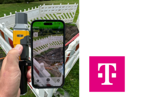
Digitale Trassenaufnahme mit GeoAce
- Schnelle Kommunikation und bessere Transparenz über tatsächlich erbrachte Leistungen
- Baubegleitung wird effizienter gestaltet
- Detaillierte Datenerfassung für Aufmaß-Vorbereitung
- Zielführende Aufgabenteilung zwischen Bauleitung vor Ort und Innendienst
Mehr Informationen...
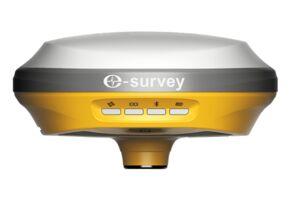
eSurvey E100 NextGen GNSS Receiver
The E100 is an 1408-channel network receiver by eSurvey GNSS. The durable IP67 design makes it possible to work in various of environments. Multi-constellation and multi-frequency tracking always gives a Fixed solution in just a few seconds, even under difficult conditions.
The E100 supports tilt compensation up to 60 degrees and makes any stakeout application super-fast.
Thanks to the very small-size and lightweight design, the E100 is suitable for all surveying and mapping applications.
Learn more...
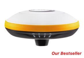
eSurvey E300 Pro NextGen GNSS Receiver
The eSurvey E300 Pro delivers unmatched GNSS performance, speed and accuracy to boost your productivity like never before. The 1408 channels GNSS receiver performs exceptional in challenging GNSS conditions and robust IMU-based tilt compensation up to 60 degrees that lets you forget about leveling the pole, you'll get more done faster than you thought possible.
The integrated E300 Pro UHF-radio is compatible with other major manufacturers and can use base station data from Trimble, Leica, Topcon and others.
Learn more...
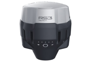
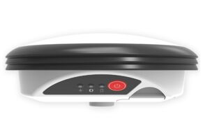
Emlid Reach RS3
Multi-band RTK GNSS receiver with centimeter precision to extend and improve the accuracy of our Augmented Reality solutions for surveying, utilities and construction. It supports tilt compensation up to 60 degrees.
The receiver tracks signals from all satellite constellations (GPS, GLONASS, Galileo, BeiDou and QZSS), provides precise centimeter-accurate positions within a few seconds and maintains robust performance even in challenging areas.
The Emlid Reach RS3 can be easily connected via Wi-Fi or Bluetooth to any iOS, Android or Windows device. It's the most affordable survey-grade GNSS receiver with prices start at € 2,499 (excl. VAT).
Learn more >
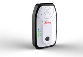
Leica Zeno FLX100 plus Smart Antenna
The Leica Zeno FLX100 plus smart antenna captures spatial data in a simple and flexible way allowing you the freedom to work how you want. This new model is also compatible with iOS devices.
A universal handheld tray enables you to pair the FLX100 plus with your own smartphone or tablet. For higher accuracy data capture just use a survey pole leveraging HxGN SmartNet RTK technology.
Learn more >
Leica Zeno GG04 plus Smart Antenna
The rugged, flexible and easy-to-use smart antenna utilises RTK technology and can now apply Precise Point Positioning (PPP). This makes high-accuracy data collection possible in real-time even in the most demanding of locations without the need for a mobile data connection.
With its compact, lightweight design and IP68 durability, you can work longer in all conditions - the world of high accuracy mapping comes to life at your fingertips.