
GeoAce - Visual Surveying
GeoAce turns your smartphone or tablet into a precise, centimeter-accurate surveying system, without the need to use GNSS receivers or total stations.
It uses Visual SLAM positioning and Augmented Reality technology to accurately determine the position of your smartphone/tablet in space and collect 3-dimensional data at the same time directly in the video stream. It doesn’t rely on GNSS positioning, so it can be used also indoors, under tree coverage and even in underground mining. You can connect external GNSS receivers to further increase the versatility of the application.
Features:
- Import / Export: GeoJSON, PDF, CSV, SHP, DXF, DWG, DGN, Smallworld, OSM, GPX
- Data collection in Augmented Reality
- External GNSS and Apple Watch support
- Visual Stakeout
- Sketch & dimensions
Download GeoAce now and use all features 7 days for free.
Precise Surveying with Your Smartphone
GeoAce is ideal for digital construction documentation, surveys, area measurements, billing in civil engineering, measuring house connections or for planning tasks. New objects are simply measured directly in the video image of the smartphone or tablet. Additional hardware such as expensive GNSS receivers, total stations or laser range finders are not required.
The GeoAce app was specially developed for civil engineering companies, garden and landscape designers and fitters. This means that recording and documentation can take place immediately after installation, and specially trained surveyors no longer must be called to the construction site. This saves you valuable time and money and ensures that the documentation is done efficiently.
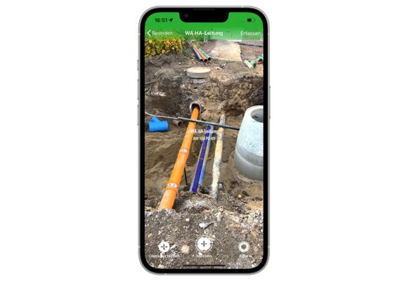
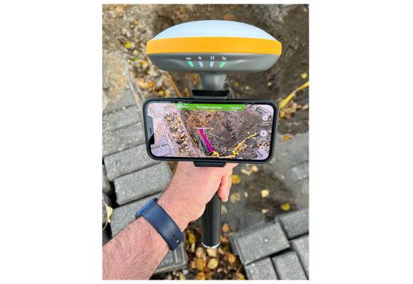
Augmented Reality GNSS Rover
Through the combination of GNSS, inertial technology and photogrammetry, objects can be captured not only traditionally with an antenna pole, but also directly with the cross hairs in the video image. That means that you can measure building corners, pipe objects in a trench or manhole covers on a busy road from a safe distance of up to 10 meters away, precisely and without additional tools.
In situations where satellite reception is no longer sufficient for centimetre-precise positions (e.g. under trees, in the forest, in underpasses, etc.), the Augmented Reality GNSS rover automatically switches to the combined inertial/photogrammetry solution and still allows a precise measurement - and all without GNSS.
Depending on the smartphone or tablet used, you can bridge distances of 100 m and more without any GNSS reception at all. A total station or other aids are no longer required.
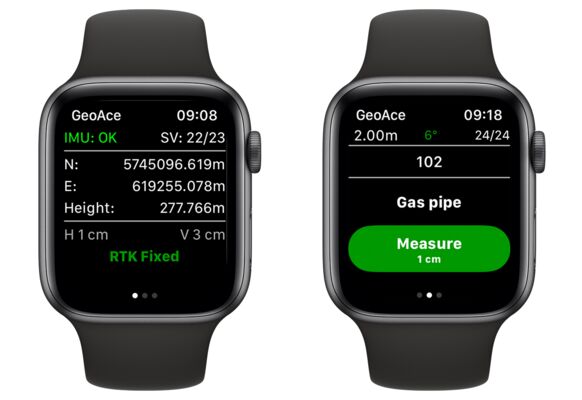
Surveying light & fast - Apple Watch
Sometimes, a surveying job needs to be completed fast, the site is difficult to reach, and you want to travel light as well. Forget the heavy and bulky data logger or tablet: All you need to carry is your GNSS receiver on a pole, your iPhone in your pocket and your Apple Watch on your wrist.
The results can be exported straight from your iPhone: full line work as PDF, DXF, DWG, DGN or SHP.
Ressources:
Download Quick Start Guide for Apple Watch (English) >
Download Quick Start Guide for Apple Watch (German) >