
ScanAce
ScanAce is a professional 3D scanning app for surveyors, construction and utility workers, archeologists, architects, and GIS professionals. It turns your smartphone or tablet into a handheld imaging laser scanner and allows you to precisely capture the reality around you and generate accurate 3D models for planning, documentation or digital twins.
All processing is done on your device, no other services or cloud connections are needed.
It is using Augmented Reality and SLAM positioning technology on your iPhone or iPad. No additional accessories are needed. ScanAce currently requires devices with a LiDAR scanner: iPad Pro (2020, 2021), iPhone 12 Pro, iPhone 12 Pro Max.
Features:
- 3D scanning
- Standard mode: 350.000 points/second
- Extreme high mode: 1.000.000 points/second
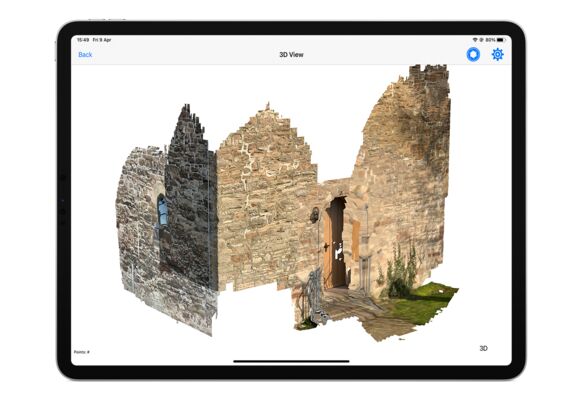
- 3D-model viewer
- Geo-reference your scan and share with the GeoAce app
- Export the RGB point cloud in E57 format
- Export textured 3D-model to OBJ format